ISP Mapping No. 4
(This article is a translation of the Burmese language version that ISP-Myanmar posted on its Facebook page on May 6, 2022.)
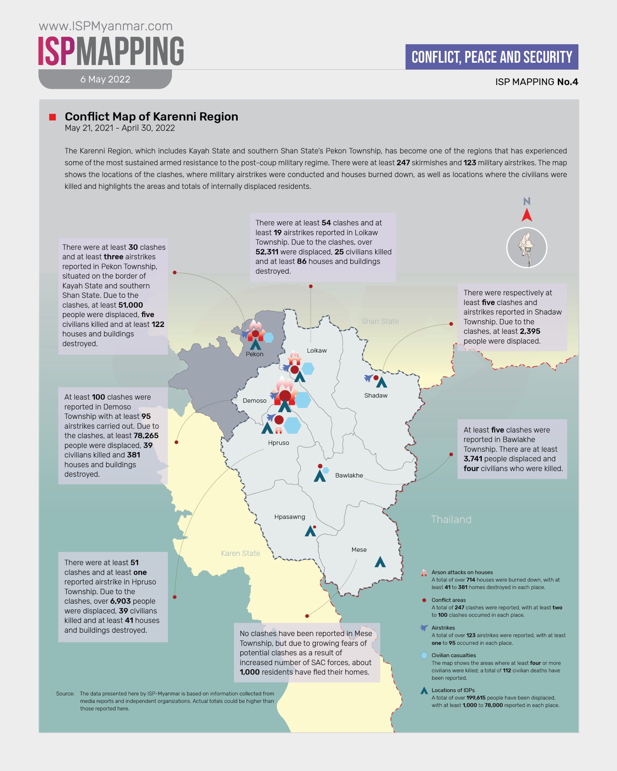
Of all Myanmar’s regions, the Karenni Region, which includes Kayah State and southern Shan State’s Pekon Township, has become one of the regions that has experienced some of the most sustained armed resistance to the post-coup military regime. There were at least 247 skirmishes and 123 military airstrikes. ISP-Myanmar Mapping shows the main areas of conflict in the Karenni region, locations of the clashes, where military airstrikes were conducted and houses burned down, as well as locations where the civilians were killed and highlights the areas and totals of internally displaced citizens. This data is based on information obtained between from May 21, 2021 and to April 30, 2022.
∎ Increasing Skirmishes and Airstrikes
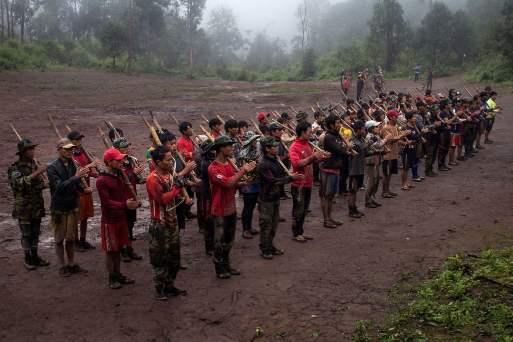
Between May 21, 2021 and April 30, 2022, there were approximately 247 skirmishes between State Administration Council (SAC) forces and at least 10 separate Karenni resistance groups, including the Karenni Army (KA), the Karenni National Defense Force (KNDF) and the People’s Defense Forces (PDFs). Initially, the Karenni resistance groups only used traditional, handmade rifles, locally known as “tumi” weapons and firearms, but they are now equipped with more sophisticated weapons, such as assault rifles, machine guns and sniper rifles. There were clashes between the two sides, as well as attacks on the SAC’s military headquarters in towns, police stations and strategic, hill-top military posts.
There were at least 123 airstrikes conducted by SAC forces between May 21, 2021 and April 30, 2022. The airstrikes involved helicopter gunships and bombings; their principle target was the Demoso Township, which suffered at least 95 airstrikes.
∎ Increasing Civilian Casualties and Destruction of Property
At least 112 civilians were killed in the clashes and airstrikes mentioned above between May 21, 2021 and April 30, 2022. Civilian casualties include those captured and killed by SAC forces, as well as those burned to death, those who were forced as human shields and later killed, those killed in artillery bombardments and those who were found and killed by SAC forces while hiding in their homes because they were unable to escape the violence.
At least 714 buildings and structures were damaged by SAC artillery shelling in the Karenni Region between May 21, 2021 to April 30, 2022. The 714 buildings that were destroyed include churches and religious buildings, as well as village houses that internally displaced citizens have been using as shelters and homes.
∎ Over 51 Percent of the Karenni Region’s Population has been Displaced
Since the beginning of organized armed resistance in the Karenni Region from May 21, 2021 to April 2022, a total of at least 199,615 people have been internally displaced. Of that total, about 78,265 are from the Demoso Township, 52,311 from the Loikaw Township, 51,000 from the Pekon Township, 6,903 from the Hpruso Township, 4,000 from the Hpasawng Township, 3,741 from the Bawlakhe Township, 2,395 from the Shadaw Township and 1,000 from the Mese Township. According to the General Administration Department in 2019, the total population of Kayah State was 390,210. Over half the population, 199,615 people (51.16 percent), have now been displaced.
∎ Why does this matter?
Looking at the number of civilian fatalities and injuries, recording the circumstances of those fatalities and injuries, and the number of people displaced by fighting involving regime forces and EAOs (or within EAOs themselves), it is possible to ascertain whether armed forces have committed human rights violations from the perspective of transitional justice. In addition, by studying the ongoing post-coup situation, further research can be conducted to examine human security matters.
∎ Other relevant readings:
First-hand reports from ethnic minority news organizations and other independent media groups provide regular updates on various conflict situations, their ongoing impact and the collateral damage in the aftermath of the military coup. These include reports of renewed fighting in ethnic minority areas, civilian fatalities, and rising refugee and IDP numbers on the ground. In addition, records and reports by United Nations organizations, such as the United Nations Office for the Coordination of Humanitarian Affairs (UNOCHA), and other independent local and foreign organizations also provide information about the ongoing conflict situation in Myanmar.